
Contact

Home
Lake Cootharaba Ruins
Two large earthquakes in southeast Queensland in the 1860s
- Fact or Fiction?
By: Russell Cuthbertson[1] and Dr. Elaine Brown[2]
Australian
Earthquake Engineering Society 2011 Conference (Barossa Valley, SA)
Date: November 8-11, 2011
Abstract
Reports of two large earthquakes being felt in southeast Queensland in the 1860s have been referred to in several scientific
papers. The accounts of the earthquakes are attributed to an explorer, John Green (c.1816-1889), who apparently travelled throughout
southeast Queensland on a number of occasions between 1851 and 1884. The notes and diaries of John Green were transcribed and self-published
in the 1990s by his great-grand-son, Brett Green.
This paper examines the earthquake reports as well as other extracts from the diaries
and compares them with other contemporary accounts. The numerous anachronisms and inconsistencies in the diaries lead us to the conclusion
that they are an unreliable source of historical information. This, combined with the complete lack of any corroborating evidence
for the earthquakes, leads us to conclude that the earthquakes are fictional.
Introduction
The Geoscience Australia (GA)
hazards report for southeast Queensland (Granger and Hayne, 2001) reproduced an extraordinary account of two earthquakes that were
observed near Lake Cootharaba, just north of Brisbane, in 1861 and 1862. The authors of the GA report did stress that these observations
had not been authenticated or corroborated. This paper aims to show that the reported earthquakes could not possibly have happened.
The
John Green Diaries
The accounts of the earthquakes are attributed to John Green (c.1816-1889), who migrated to New South Wales
in 1844, farmed in the Illawarra district of New South Wales, and apparently travelled, with his son James, throughout southeast Queensland
on a number of occasions between 1851 and 1884. The notes and diaries of John Green were transcribed and self-published in the 1990s
by his great-grand-son, Brett Green, in a series of six books under the title Tales of a Warrior (Green, 1995a, 1995b, 1996a, 1996b,
1997, 1999).
Account of 1861 earthquake at Lake Weyba
In the third book of the Tales of a Warrior series (Green 1996a, pp.
60-61), John
Green was at 'the lake called Weiba' late on the afternoon of Tuesday, 25 June 1861,
when
... the ground shook violently from a quake force deep within the soil. Trees swayed and the sea waters were in array swishing back and forth in quick succession over the sands exposed by the low waters. It was a frightening experience for I had never taken part in such an occurrence.
Account of 1862 earthquake at Lake Cootharaba
The description of the event of 3 September 1862 (Green 1996b, p. 41) is most extraordinary.
The Green party had set up camp on the shores of Lake Cootharaba.
There was an eerie quietness over the land. The birds had fled. There was no movement of the leaves not a ripple on the water. David I noted was ill at ease. He said the earth spirits were angry. A great roar sounded beneath our feet and the lands shook violently. Trees heaved upwards and downwards falling in many directions. I fell upon the ground and could not move so violent was the ground shaking and sliding one way, then the next. I could not stand no matter my effort. The horses cried out in fear as they fell upon each other trying to get upright and free all at the same time. It seemed like an eternity before it ceased. There was a hush as we quietened the horses and secured them further so that they could not escape in their fear. I was fortunate having placed the camp on high ground for the lake waters had risen considerably to a new shoreline of many feet and gained much depth of waters. New lakes had been formed as the waters rushed in taking all before them. The great shaking came again and we were thrown to the ground as jolt after jolt came forth under the ground. Great waves rolled across the waters and crashed upon the new shores filling the waters with trash and debri [sic]. More shaking occurred soon after and again and again, until it was no more than rumbles in the ground. I take notice that the lands have been changed resembling nothing like it was when we first came.
Search for corroborating felt reports
The account of 1862 describes Modified Mercalli intensities well in excess of 7. The surface
deformation required to produce the water level changes described indicate that the explorers would have been close to the epicentre.
This implies a magnitude well in excess of 6.
Figure 1: Map of southeast Queensland
showing location of earthquakes and
place names.
An earthquake of this magnitude (6+) would be expected to be felt with a reasonably high intensity for quite some distance from the
epicentre (Greenhalgh et al, 1989). For instance the magnitude (ML) 6.0 Bundaberg earthquake of 1918 was felt with MMI IV up to 600
km away into northern NSW.
At the time of the earthquake, Queensland had only just (in 1859) been made a selfgoverning colony
of Britain, separate from New South Wales. Brisbane, just 130 km to the south of the presumed epicentre, had a fledgling population
of about 6,000. It had a daily paper, the Courier, that frequently contained news from our correspondents in regional centres such
as Ipswich, Warwick and Gayndah. Other population centres that would have been within the felt area were at Maryborough, Eidsvold,
Toowoomba and Rockhampton.
Given the expected felt area, it would be reasonable to expect some reference to this earthquake in
the local media. Copies of the Courier (from Trove website, National Library of Australia) for a period of several weeks after the
September 1862 date were studied, with no mention being found of anyone reporting the shaking from an earthquake. The Courier also
has no record of the lesser 1861 event.
Authenticity of the Green diaries
The authenticity of the Green diaries has been
challenged by local historians, Aboriginal historians (Gympie Times, 1998b) and Green family historians (Gympie Times, 1998a). Brett
Green claims that the original diaries were lost in a fire at his home, so it is now not possible to check the many inconsistencies,
anachronisms and
factual errors detectable in the published texts.
Many of John Green's descendants contributed to The Green Book (1999),
a family history published by Grayeme and Lynne Bone (Bone and Bone, 1999). Green family historians assert that their ancestor could
not have written the long, wordy accounts attributed to him because he was illiterate. They point to differences in the signature
on John Green's will and a signature published by Brett Green. They also claim that John Green never visited Queensland (Gympie Times,
1998a).
John Green's presence in Queensland has not been verified. If he was in the Moreton Bay colony between 1851 and 1859,
for example, his name should appear in the comprehensive Pre-Separation Index (1990), but the only John Green listed there is a convict.
If the John Green of Tales of a Warrior does not appear in such a wide range of records, it is probable that he was not in Queensland
before 1859. On his visits in the 1860s, he also seems to have dodged detection, as his name and activities do not appear in any records
so far examined.
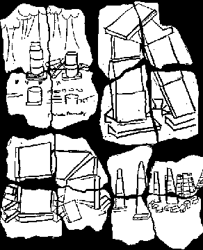
Reports of ancient structures
The accounts of the two earthquakes both refer to a 'stone structure of columns
and an archway' with 'symbols ... imprinted on their ancient stones'. These were observed and recorded by John Green in 1861, but
they 'collapsed, shattered upon the ground, only to be covered by the new levels of the lake waters' as a result of the earthquake
of 1862 (Green, 1996a, p. 46 and 1996b, p. 41), so their existence cannot be verified today .
The theme of finding ancient structures
recurred in another Brett Green book, The Gympie Pyramid Story (Green, 2000). In 2007, the Department of Main Roads employed a team
of archaeologists to investigate the supposed Gympie Pyramid site, but they were unable to confirm the existence of such a structure
(ARCHAEO
Cultural Heritage Services, 2008).
Contemporary explorers and squatters
At the time of Queensland's separation from
New South Wales in 1859, the Noosa River (which flows through Lake Cootharaba) was known to exist, but had not been officially explored
or mapped (Graham, 1836; Heath, 1861).
In 1860, Lt John O'Connell Bligh of the Native Mounted Police approached the river from
the west with his Aboriginal troopers. His report on its chain of lakes, good timber and promising agricultural land was published
in the Wide Bay and Burnett Times and then the Moreton Bay Courier (1860). In 1860, Bligh applied to the
Commissioner for Crown Lands
in Maryborough for a cattle run named Caroora, which took in much of the Upper Noosa River (Register of Runs, p. 110). Two months
earlier, Walter Hay, a noted speculator, had applied for a cattle run named Coutharaba, on the western side of Lake Cootharaba (Tenders
for Runs, p. 145). Both
runs were granted in September 1860.
These two applications suggest that the western side of Lake Cootharaba
was visited and subject to some pioneering activity just before the events described by Green in 1861 and 1862. Neither Bligh nor
Hay mentioned seeing stone ruins on the western shore of the lake.
In September 1863, the Brisbane sawmiller and surveyor William Pettigrew visited the Noosa River in his steamship, looking for timber.
After exploring the lakes, he published his observations in the Queensland Daily Guardian (Pettigrew, 1863).
Although he spoke
with Aborigines, neither his report nor his diary mentions earthquakes or any disturbances that might be attributed to the events
described by John Green in 1861 or 1862. In June-July 1865, Pettigrew returned and mapped the Noosa River as far north as the entrances
of Kin Kin Creek and the Upper Noosa
River into Lake Cootharaba (Pettigrew, 1865).
Anachronisms and inconsistencies with other
contemporary accounts
It is a characteristic of John Green, throughout the Tales of a Warrior series, to write Aboriginal words
to show a variety of pronunciations a remarkable effort for an illiterate man. He also offers place names, many of which appear
to be derived retrospectively from available Aboriginal vocabularies, such as F.J. Watsons Vocabularies of Four Representative Tribes (Watson,
1943-44). One place name that is clearly fabricated is 'Pbomerra or Pbomeronga', which Brett Green equates with the town of Pomona
(Green 1996a, p. 49). Pomona was in fact named by Henry Armitage, a local settler, in 1900. The authorities had rejected an earlier
suggestion, Cooroora, because of possible confusion with the towns of Cooroy to the south and
Cooran to the north (Gillespie, 2000).
Unusual
wording, which is also characteristic of John Green's writings, is a clue to the unreality of the Tales of a Warrior series. For example,
John Green used the collective term 'clan', while contemporary writers, such as George Harris (c1923) and Ebenezer Thorne (1876),
used 'blacks' or 'tribes'.
Another questionable term frequently used by Green is 'dugout'. It is curious that his 1861 passage
refers to 'dugout canoes', while his 1862 passage refers to both 'dugout' and 'bark' canoes. In the waterways of coastal southeast
Queensland, Aboriginal canoes were made of bark (Petrie, 1975).
It is also curious that, according to John Green, one clan made
pottery and a neighbouring clan made possum-skin drums (Green, 1996a, p. 54 and pp. 59-60).
There is no evidence that the Aborigines
of coastal southeast Queensland made such pottery or such drums.
The journalist Ebenezer Thorne, who lived 'on the Newsa waters'
from 1865 to 1867, presented a lively account of the daily life, customs, ceremonies and beliefs of the two 'tribes', 'some hundreds
in number', who then lived in the area. His accounts of the place and its people (Thorne, 1876) are very different from those of John
Green.
Summary
The extraordinary description of an earthquake on the shores of Lake Cootharaba in 1862 does not fit with other
evidence. The lack of any corroborating felt reports for the period, in Brisbane particularly, indicates that the account was either
exaggerated or fictitious.
The discrepancies and anachronisms in much of the remaining sections of the publications would indicate
the second possibility is more likely.
Sintubin et al. (2008) describe how an earthquake is sometime manufactured to explain
some unusual observations. They state that
... the danger is that such rogue earthquakes, supposedly proven by archaeologists, will be used by seismologists as real events in a seismichazard analysis ...
We hope that this article will lay to rest the myth of the earthquakes that were reported felt at Lake Cootharaba and Lake Weyba in 1861 and 1862.

REFERENCES
ARCHAEO Cultural Heritage Services, 2008. Cultural Heritage Survey of Rocky Ridge, Gympie, South East Queensland
in Bruce Highway (Cooroy to Curra) Strategic Planning Study: Recommended Corridor Report. Queensland Department of Main Roads.
Bone,
Grayeme and Bone Lynne. 1999. The Green Book: A History and Genealogy of the family of John Green (c.1816-1889). Glenreagh NSW.
Gillespie,
Aline, 2000. Pomona: The Historical Centre of Noosa Shire: A New Town 1900: A New Shire 1910. Coroora Historical Society Inc., pp.
2-4.
Graham, John, 1836. to Foster Fyans, 6 September 1836, AONSW REF 4/2325.4 in Dwyer, Barry and Neil Buchanan (1986). The
Rescue of Eliza Fraser, pp. 28-32;
Heath, George., 1861. Report on the New Harbour, 23 April 1861 in Harbours and Marine (1986).
Brisbane: Dept. of Harbours and Marine, p. 69.
Granger, K. and Hayne, M., 2001. Natural Hazards and the risk they pose to Southeast
Queensland. AGSO-GA and Bur. of Met.
Green, Brett J. (1995a). Tales of a Warrior: Kabi Legends of the Central Mary River, Gympie,
Qld, transcribed from the diaries and notes of John and James Green (1820-1938). 1. The Legend of Gympie.
Green, Brett J. (1995b).Tales of a Warrior: Legends and stories about the Kabi speaking peoples of the Mary River valley and Gympie, Qld, transcribed from
the diaries and notes of John and James Green (1820-1938). 2. The Clans of Kippandingi.
Green, Brett J. (1996a). Tales of a Warrior:
Legends and stories about the Kabi speaking peoples of the Gympie and Cooloola/Sunshine Coast regions of S.E. Queensland, transcribed
from the diaries and notes of John and James Green (1820-1938). 3. The Clans of Yuludara.
Green, Brett J. (1996b). Tales of a
Warrior: Legends and stories about the Kabi speaking peoples of the Gympie/Cooloola/Fraser Island and Sunshine Coast regions of S.E.
Queensland, transcribed from the diaries and notes of John and James Green (1820-1938). 4. The Great Holes of Kugululu and the New
Lands.
Green, Brett J. (1997). Tales of a Warrior: Legends and stories about the Kabi speaking peoples of the Gympie/Cooloola/Fraser
Island/Gayndah/Burnett and Sunshine Coast regions of S.E. Queensland, transcribed from the diaries and notes of John and James Green
(1840-1938). 5. Land of Legends.
Green, Brett J. (1999). Tales of a Warrior: Legends and stories about the Kabi speaking peoples of
the Gympie/Cooloola/Fraser Island and Sunshine Coast regions of S.E. Queensland, transcribed from the diaries and notes of John and
James Green (1820-1938). 6. The Spiritual Journey.
Green, Brett J. 2000. The Gympie Pyramid Story. Gympie: De Grene Enterprises.
Greenhalgh,
S., Denham, D., McDougall, R., and Rynn, J.M., 1989. Intensity relations for Australian earthquakes. Tectonophysics, 166, 255-267.
Gympie
Times (1998a). The Green Diaries: Authors Claims Disputed, Gympie Times, 25 April 1998.
Gympie Times (1998b). Aborigines
dismiss diaries, Gympie Times, 19 May 1988.
Harris, George. c.1923. Reminiscences of my Early Days in Ipswich, typescript,
Fryer Library, University of Queensland
Pre-Separation Population Index of Moreton Bay Region 1824-1859, 1990. Brisbane: Queensland
Family History Society. Microfiche.
Moreton Bay Courier, 11 October 1860.
Petrie, Constance Campbell, 1975. Tom Petries
Reminiscences of Early Queensland. Hawthorn: Lloyd ONeill, pp. 97-99.
Pettigrew, William. 1863. A Trip to Noosa and the Lakes,Queensland Daily Guardian, 1 October 1863.
Pettigrew, William. 1865. Map of Coast from Bribie Island to Fraser Island. (Title
obscured.) Sunmap Museum.
Register of Runs, 1850s, Commissioner for Crown Lands, Wide Bay and Burnett, p. 110. Queensland State
Archives.
Sintubin, M., Stewart, I. S., Niemi, T., Altunel, E. and Malone, S. 2008. Earthquake Archaeology Just a Good Story?
Seismological Research Letters, `79, 6 (Nov-Dec).
Tenders for Runs. Copies of Commissioners Reports on Tenders for Runs, February
1855-July 1860, Commissioner for Crown Lands, Wide Bay and Burnett, p.145, Queensland State Archives.
Thorne, Ebenezer. 1876.Queen of the Colonies or Queensland as I knew it by an Eight Years Resident. London: Sampson, Low, Marston, Searle and Rivington.
Watson, F.J. 1943-44. Vocabularies of Four Representative Tribes of South East Queensland: with Grammatical Notes thereof and
some Notes on Manners and Customs. Journal of the Royal Geographical Society of Australia (Queensland), Vol. 9, No. 34.
Gympie Pyramid Hoax:
Yowie Research Fakery:
The Ruins of Lake Cootharaba?
More on Brett Green from Yowieocalypse: